Matt Anderson
  • Home
  • Projects
  • Publications
  • Experience
  • My Paper
  • Projects
  • Projects
  • Experimental Demonstration of Bistatic UAV-Borne SAR and InSAR
  • MAGIC-VFM - Meta Adaptive Control for Ground Vehicles with Visual Foundation Models
  • Learning-based Minimally-Sensed Fault-Tolerant Adaptive Flight Control
  • Experience
  • Online Self-Supervised Thermal Water Segmentation for Aerial Vehicles
  • UAV-Borne Bistatic Sar and Insar Experiments in Support of STV and SDC Target Observables
  • Hardware Designs
  • UAS Flight Testing in Support of Research for Academia: Lessons and Experiences from the Field
  • NeBula: TEAM CoSTAR's Robotic Autonomy Solution that Won Phase II of DARPA Subterranean Challenge
  • Satellite Formation Flying for Surface Topography and Vegetation (STV) Mapping: The Distributed Aperture Radar Tomographic Sensors (DARTS)
  • Development of Ultra-Wideband Software Defined Radar Testbed to support SAR Tomographic Mission Formulation
  • Distributed Aperture RADAR Tomographic Sensors (DARTS) to Map Surface Topography and Vegetation Structure
  • Experiments with Small UAS to Support SAR Tomographic Mission Formulation
  • Neural Tree Expansion for Multi-Robot Planning in Non-Cooperative Environments
  • AFA
  • DARTS
  • F9P GPS Logger Board
  • kvis
  • SQUID
  • SubT
  • swarmAI
  • Teensy 4.0 Breakout Board
  • Volcano Drone
  • ulg Reader (MATLAB)
  • Design of the Next-Generation Autonomous Flying Ambulance
  • Development and Deployment of an Autonomous UAV-Borne Gas and Particulate Sample Capture System for Fumarole Sampling
  • Design and Autonomous Stabilization of a Ballistically-Launched Multirotor
  • Arduino Software
  • R/C Fun
  • An example preprint / working paper
  • Flight Experimentation Towards Enhanced UAV Capabilities – The Multi-rotor Air-Crane
  • Modelling Small Electric Brushless Motors and Propellers
  • An example journal article
  • Modelling Propellers in FINE/Open using OpenLabs
  • Propeller Location Optimisation for Annular Wing Design
  • An example conference paper

DARTS

May 9, 2021 · 1 min read

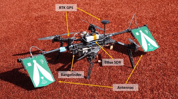
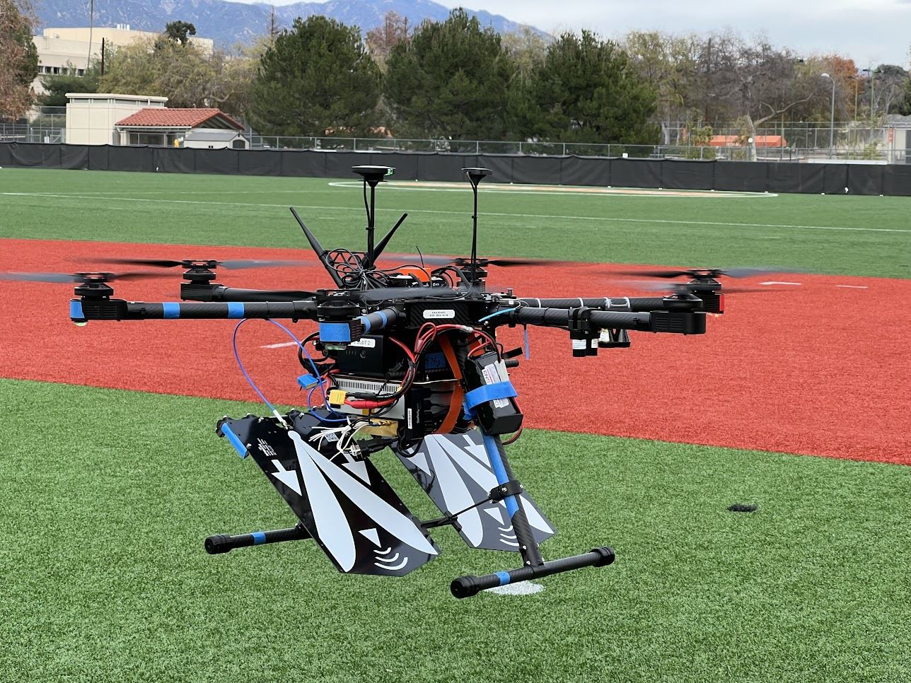
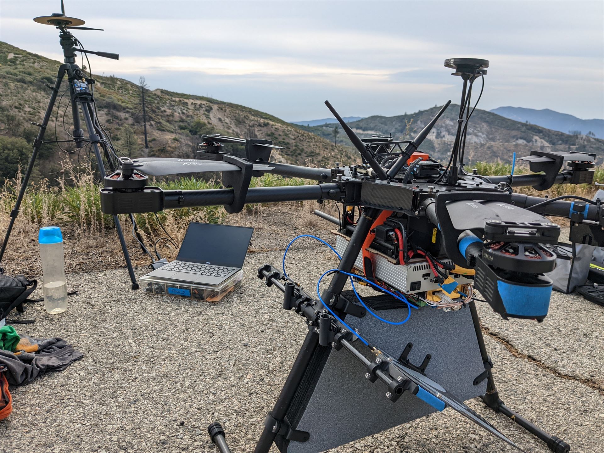
Enhance global mapping of surface topography and 3D vegetation using multi-static SAR observations. Below are some images taken during some of our flight tests at North Field, Caltech.

DARTS Flying
DARTS Flying
DARTS Flying

Last updated on May 9, 2021
Aero
Matt Anderson
Authors
Matt Anderson
Staff Scientist

← AFA May 9, 2021
F9P GPS Logger Board May 9, 2021 →

© 2025 Matt Anderson. This work is licensed under CC BY NC ND 4.0

Published with Hugo Blox Builder — the free, open source website builder that empowers creators.